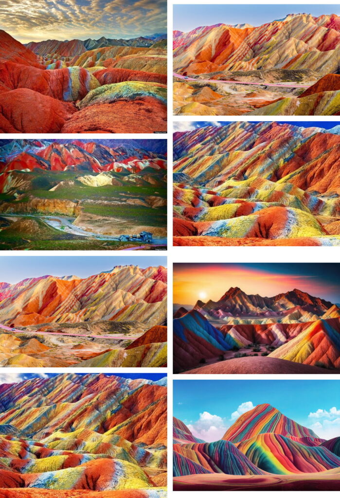
Incredible cretaceous color
29 December—Yesterday, when I turned on my desktop computer (I don’t boot anything; and it’s short for bootstrap anyway, which I don’t do either), my gob was positively smacked to find on the Windows start-up screen what appeared to be an enhanced picture of what the caption told me was the Zhangye National Geopark.
Geopark? A geopark, I discovered, is a protected area with outstanding geological significance that’s used to support so-called sustainable development (as opposed to silly Sustainable Litchfield), including conservation, education, research, and (of course) tourism. UNESCO has a Global Geoparks Network. There are no geoparks in the United States, five in Canada, and one in Mexico; there are a few so-called aspiring geoparks in the U.S. and Canada.
Although the Zhangye Danxia Landform Geological Park is supposed to be a famous natural wonder of the world, I had never heard of it. Shame on me. I had been thrilled driving through Alpine clouds and awed flying around the Grand Canyon. And had I known about the incredible Zhangye’s Rainbow Mountains in my pre-blasé days . . . you never know.
The magnificent Rainbow Mountains are formed of cretaceous sandstone and siltstone that were deposited in China over 55 million years ago, before the Himalayan Mountains were formed. The iron and trace minerals are what formed the colors that make Zhangye what it is today.
I reckoned that the light and color balance of the start-up photograph used by Microsoft may have been played with a bit, but probably not too much, judging by other pictures I found of Zhangye. What’s known as China’s Rainbow Mountains turns out to be for real.
Here are some pictures to prove it: